

Avalanche Forecast published on November 9, 2017 @ 7:06 am
Issued by
Zach Guy - Flathead Avalanche Center
Whitefish Range
Swan Range
Flathead Range and Glacier National Park
How to read the forecast
Early Season Snowpack Update: New snow on Thursday and Friday accompanied by increasing southwest winds will form fresh wind slabs on high elevation, leeward aspects. Thicker drifts, shooting cracks, or drifting snow are signs to be wary of steep, wlndloaded terrain. Early season obstacles are prevalent, and a small avalanche could result in a harsh ride over rocks and vegetation.
The FAC will monitor conditions through the fall and post updates as the snowpack evolves.

No Rating
?
Above 6500 ft.
No Rating
?
5000-6500 ft.
No Rating
?
3500-5000 ft.
Avalanche Problem 1: Wind Slab
-
Type ?
-
Aspect/Elevation ?
-
Size ?HistoricVery LargeLargeSmall

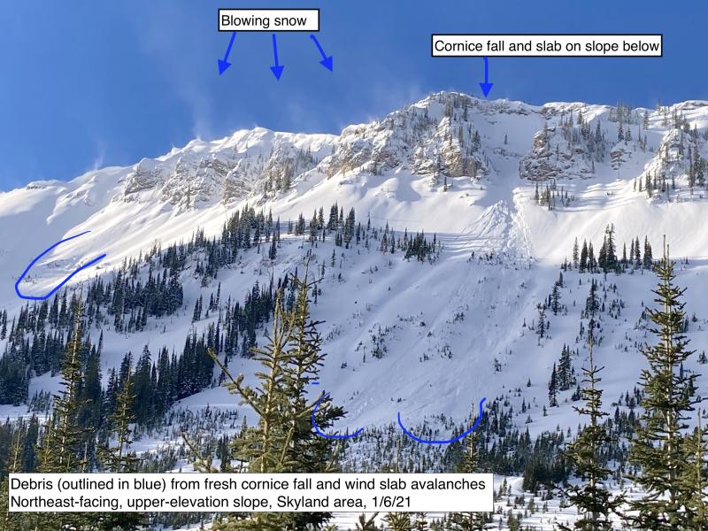
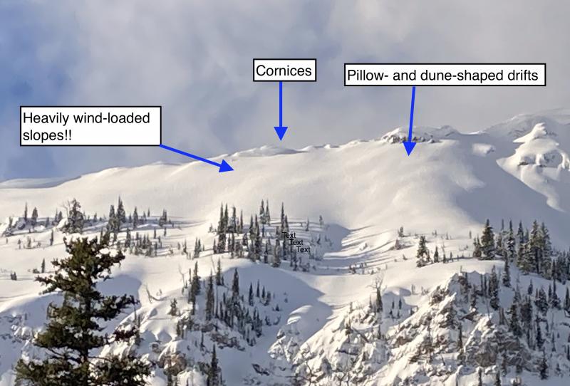
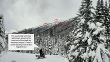
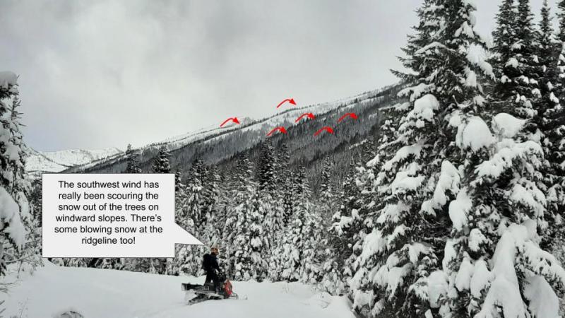
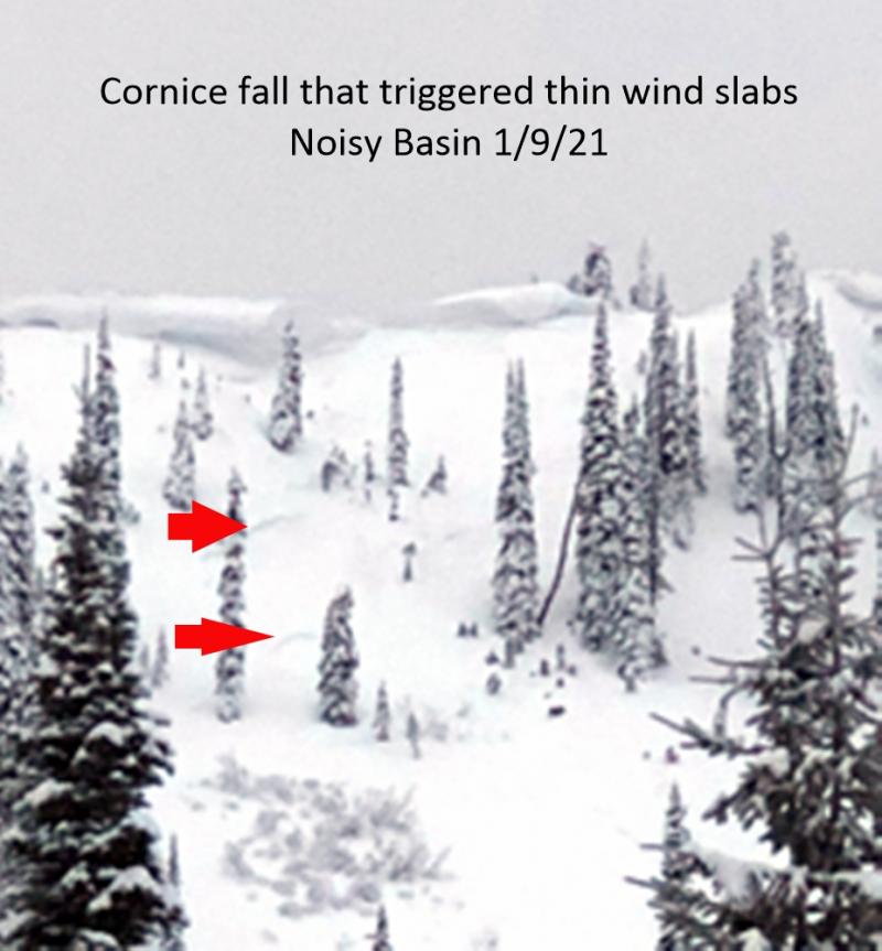
The mountains are forecasted to pick up 3-5" of dense snow over the next couple of days, with southwesterly winds increasing Thursday night into Friday. Expect to find shallow windslabs forming below alpine ridgelines and in cross loaded gullies or features (See photo). These slabs will be forming over a layer of low density or faceted snow, and won't immediately bond well. Use caution in steep, windloaded terrain, especially where the terrain consequences could amplify the results of an avalanche.


Forecast discussion
The last week of cold, dry weather has promoted near-surface faceting, especially on slopes holding shallow snow depths (See this video). This layer will not immediately bond well to any arriving slabs. Snow accumulations with this system look fairly modest, but winds will be building thicker slabs at higher elevations that will be sensitive underfoot.
Freezing levels are on the rise and we will see rain-on-snow reaching as high as 4,500 feet with this system. The snowpack is still too thin at lower elevations for significant avalanche concerns, and I don't expect signficant wet loose avalanche action to come from this event. Watch for isolated exceptions on steep, gullied terrain.
Weather and CURRENT CONDITIONS
weather summary
A warm front will spread precipitation across Northwest Montana on Thursday and Friday. Freezing levels are forecasted to rise to 4,000 feet over the next two days, and southwest winds will start cranking Thursday evening, gusting into the 40's and 50's at ridgetop elevations. Snowfall and wind speeds will fizzle this weekend, but another system arrives early next week. The National Weather Service in Missoula has begun daily backcountry weather forecasts for Northwest Montana here. We will resume detailed daily weather forecasts when we become fully operational.
Disclaimer
This advisory applies only to backcountry areas outside established ski area boundaries. This advisory describes general avalanche conditions and local variations always occur. This advisory expires at midnight on the posted day unless otherwise noted. The information in this advisory is provided by the USDA Forest Service who is solely responsible for its content.
Search
Follow or Subscribe


In Partnership With

In Partnership With
