

Avalanche Forecast published on November 13, 2017 @ 6:33 pm
Issued by
Chris Bilbrey - Flathead Avalanche Center
Whitefish Range
Swan Range
Flathead Range and Glacier National Park
How to read the forecast
Early Season Snowpack Update: Expect changing avalanche hazards over the next 48 hours with the arrival of new snow and strong southwest winds. Cracking snow in windloaded terrain is a sign of instability indicating avalanches will be sensitive to human triggers, with an unpleasant ride giving way to potentially high consequences.
The FAC will monitor conditions through the fall and post updates as the snowpack evolves.

No Rating
?
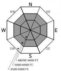
Above 6500 ft.
No Rating
?
5000-6500 ft.
No Rating
?
3500-5000 ft.
Avalanche Problem 1: Wind Slab
-
Type ?
-
Aspect/Elevation ?
-
Size ?HistoricVery LargeLargeSmall

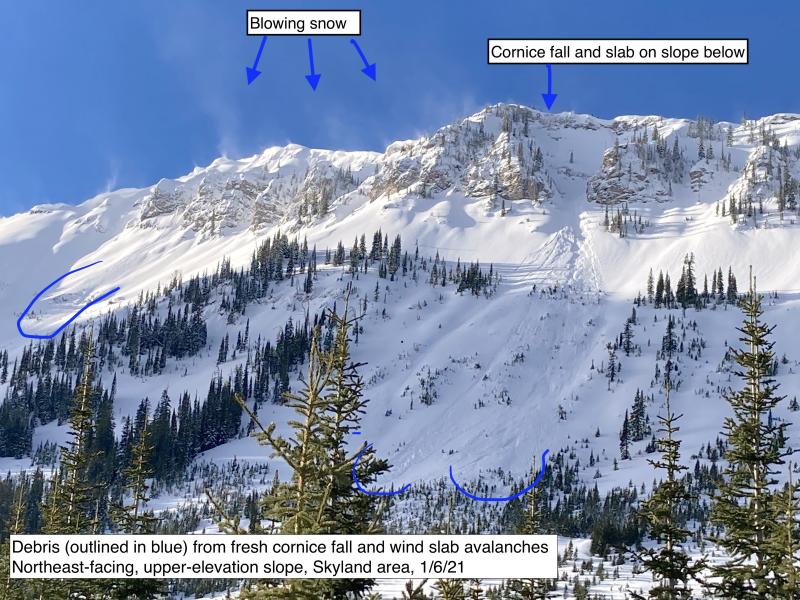
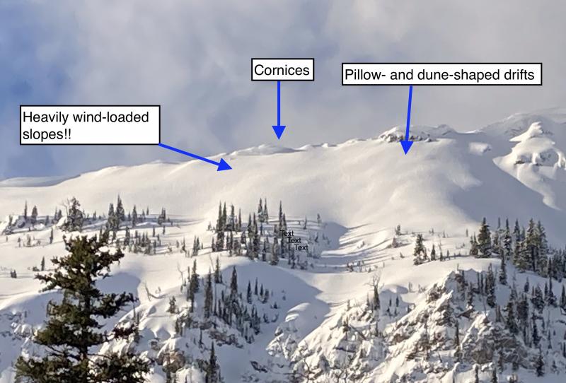
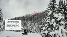
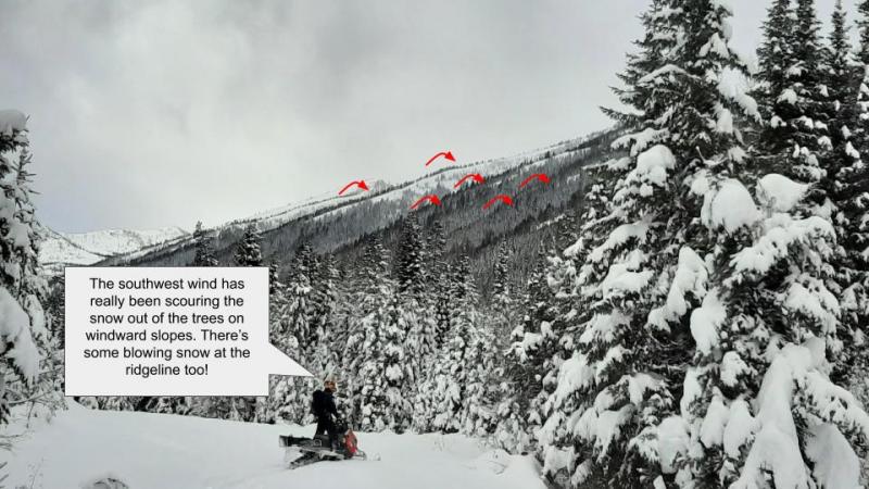
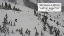
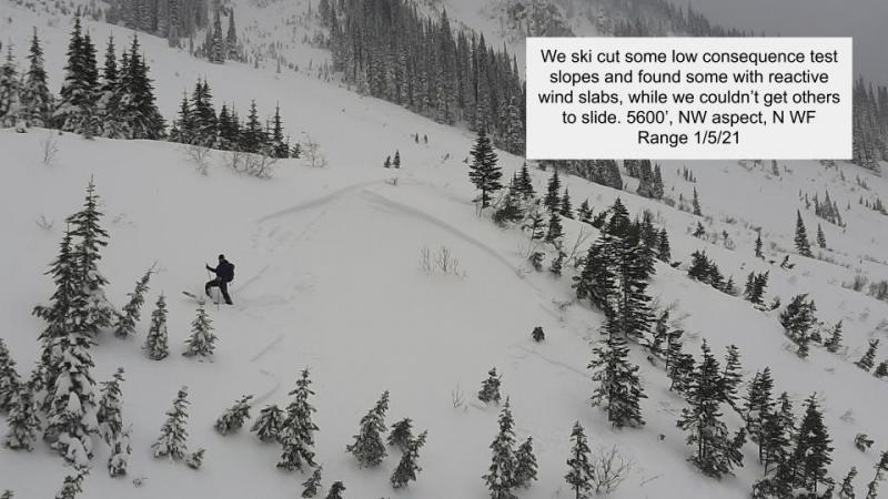
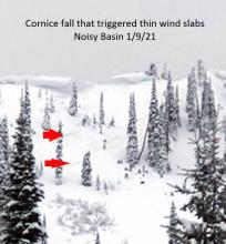
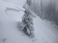
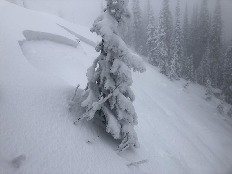
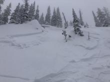
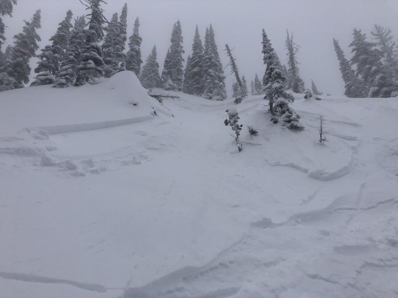
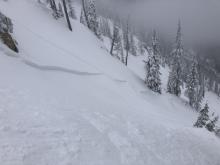
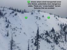
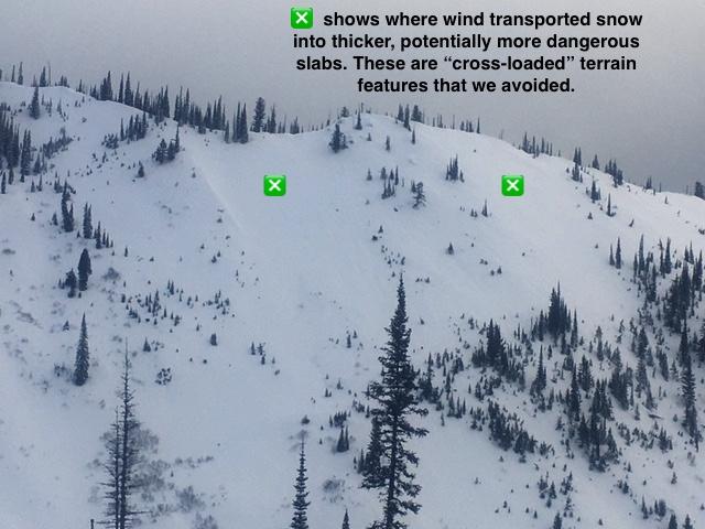
Southwest will be drifting fresh snow into deeper, windloaded pockets on leeward and crossloaded slopes at higher elevations. With up to 8" of new snow on tap and ridgetop wind speeds forecasted to reach 25-40 mph, watch for wind slabs to grow in size and sensitivity over the next couple of days. Avoid deeper drifts and pillowy looking snow on steep terrain, such as these recent avalanches.


Avalanche Problem 2: Storm Slab
-
Type ?
-
Aspect/Elevation ?
-
Size ?HistoricVery LargeLargeSmall
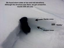
If we see the high end of forecasted snow totals over the next few days, shallow storm slabs may be sensitive to human triggers on steep terrain at mid and upper elevations. Monitor new snow totals with quick hand pits and keep a careful eye for cracking in the new snow. Use extra caution if you find more than 8" of new snow in consequential terrain.


Forecast discussion
Total snowfall from this approaching system will dictate how widespread and reactive new storm instabilities will become. Pay attention to the duration and intensity of snowfall throughout the next few days, and look for signs of significant wind transportation at higher elevations.
Recent observations have noted a fairly uniform snowpack with no obvious weak layers on south and west aspects. On northwest to northeast aspects at upper elevations, our snowpack consist of a relatively homogenous slab sitting on top of a basal crust/ facet combo leftover from mid-October storms. Slab depths up to 70 cm are primarily isolated to shady, higher elevation terrain that benefited from prior northeasterly winds. On some slopes, we have found unconsolidated facets lurking below the crust. Although our stability tests haven't been producing propagating results at this slab/ crust interface, the potentially larger consequences of a surprise from this basal layer are worth assessing with continued loading. On Friday, observers noted a large avalanche that had stepped down to the ground on a rock slab, which may have been related to this worrisome structure (see photo). We still have limited field data on the distribution and reactivity of these underlying facet/crusts right now. Place your shovel into the snow to determine if the crust/facet layers exist and the depth of the overlying slab, and default to sunnier aspects, lower elevations, or lower angled terrain if in doubt. Even on the low angle slopes, it is far from green-light riding conditions with our very thin snowpack and countless buried obstacles. Tread lightly if you are headed out for turns and be prepared for the worst, including shovel, probe, beacon, first aid kit, and plenty of warm layers.
Weather and CURRENT CONDITIONS
weather summary
Our next storm is approaching the Washington coast with an associated cold front moving over NW Montana this evening. The front is accompanied by a southwest wind flow. Strong southwest winds are expected with frontal passage along with lowering freezing levels. Snow levels are initially starting at around 5000 ft and lowering to around 3500 ft after the front passes later tonight. Tuesday afternoon is a transition period before our next storm arrives on Wednesday. Over the next 48 hours, expect 3-6" of snow below 5000 ft and 6-8" above 5000 ft with the possibility of 0.5" SWE.
Disclaimer
This advisory applies only to backcountry areas outside established ski area boundaries. This advisory describes general avalanche conditions and local variations always occur. This advisory expires at midnight on the posted day unless otherwise noted. The information in this advisory is provided by the USDA Forest Service who is solely responsible for its content.
Search
Follow or Subscribe


In Partnership With

In Partnership With
