| Friday | Friday Night | Saturday | |
|---|---|---|---|
| Cloud Cover: | Mostly Cloudy | Mostly Cloudy | Mostly Cloudy |
| Temperatures: | 22 to 29 deg. F. | 10 to 15 deg. F. | 24 to 32 deg. F. |
| Wind Direction: | Southwest | Southwest | Southwest |
| Wind Speed: | 5 to 15 G25 | 5 to 15 G25 | 0 to 10 |
| Snowfall: | 2" to 5" in. | 1" in. | 0" in. |
| Snow Line: | 1500' | 1500' | 1000' |
Flathead Range and Glacier National Park
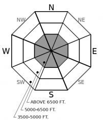
How to read the forecast
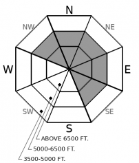
The danger is only slowly diminishing since two incidents involving large persistent slabs occurred on Wednesday. The snowpack becomes increasingly complex and harder to manage as you gain elevation: cautious travel is paramount. The safest riding today is on low angle slopes or sheltered terrain below about 5,700'.

2. Moderate
?
Above 6500 ft.
2. Moderate
?
5000-6500 ft.
1. Low
?
3500-5000 ft.
- 1. Low
- 2. Moderate
- 3. Considerable
- 4. High
- 5. Extreme
-
Type ?
-
Aspect/Elevation ?
-
Likelihood ?CertainVery LikelyLikelyPossible
 Unlikely
 -
Size ?HistoricVery LargeLargeSmall

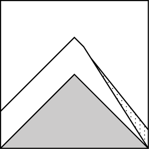
Two separate groups on Wednesday were surprised by large persistent slab avalanches - one was remotely triggered from a ridgeline and failed on a surprisingly low angle slope, the other released on the second skier to cross the slope. Slabs are breaking 18" to 36" deep on buried facets or faceted crusts, weak layers that are slow to heal. Erratic feedback, unusual behavior such as triggering from below or adjacent to a slope, and challenging spatial variability are all common annoyances of persistent slabs. It can be difficult to tease out the troublemaker slopes, so give yourself an extra wide margin for error. The easiest way to reduce your risk today is to ride on slopes less than 30 degrees in steepness or in terrain below about 5700' or so. Careful snowpack assessments, especially on northerly and easterly aspects, are critical if you venture towards steeper, higher elevation slopes. Collapses or shooting cracks are clear warning signs, though their absence is not a hall pass to steep terrain.
-
Type ?
-
Aspect/Elevation ?
-
Likelihood ?CertainVery LikelyLikelyPossible
 Unlikely
 -
Size ?HistoricVery LargeLargeSmall

Alternating winds in the past few days have formed slabs of drifted snow near high elevation ridgelines or in crossloaded terrain features. Be on the lookout for blowing snow, thicker drifts, and cracking under foot or machine. Winds have shifted from northeast to southwest and have had ample loose snow for winds to drift, and cold temperatures have delayed the healing process. Steer away from recent or fresh deposits of drifted snow.
-
Type ?
-
Aspect/Elevation ?

-
Likelihood ?CertainVery LikelyLikelyPossible
 Unlikely
 -
Size ?HistoricVery LargeLargeSmall

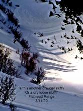
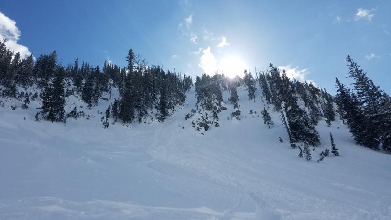
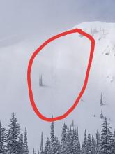
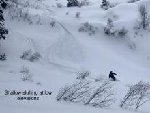
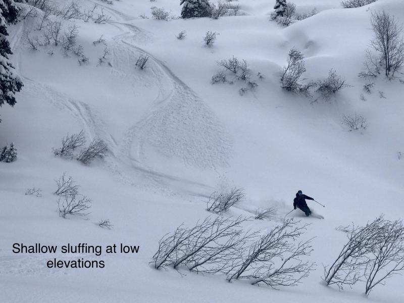
Forecasts are calling for up to 5" of new, low density snow today, which will accumulate on top of loose, soft snow surfaces. Watch for natural or triggered sluffs, especially in areas with high snowfall rates or if the sun breaks through the clouds, like this natural avalanche yesterday. Loose dry (or point release) avalanches start as small, easy to manage avalanches, but they can entrain enough snow to push you into a terrain trap or bury you in the wrong type of terrain. Be careful in steep gullies or above cliffs, creeks, and trees.
I'll use an analogy that we are all too familiar with right now, which, in no way, should be interpreted as medical advice. Let's compare our persistent slab problem to our current health care predicament. We've all become comfortable handling wind slabs, loose snow avalanches, and storm slabs in the past few months - these are the common colds and flus of the avalanche world. They can certainly be harmful, but they are also easier to identify and manage. You go about your life as normal during flu season. Now we have a persistent slab issue, one that has higher consequences. Hello COVID-19. Our forecast staff has limited resources to test every slope, so we have uncertainty about how widespread the issue is, but we have clear evidence of a few confirmed cases. Furthermore, some of "our patients" are asymptomatic - they don't give good feedback, while many others simply aren't a problem - they don't have the weak layer or the slab. But because of our uncertainty, we have to treat every slope as guilty until proven innocent. In Flathead County, we have 18 confirmed COVID cases; the odds are in your favor that you could go high five all of your neighbors and everyone you see in the grocery store and then pick your nose --- and you'd probably turn out fine. The danger to yourself is MODERATE; we aren't in New York City after all, where the odds are stacked against you. But you aren't doing that right now, are you? You're nervous. So are we of persistent slabs. The odds are in your favor that you can ride a random selection of avalanche terrain all day and walk away unscathed. But practicing extra cautious protocols is the most reliable way to handle this consequential and difficult to identify problem. Unlike COVID-19, persistent slabs won't get exponentially worse; they will start to heal with time. The cold temperatures this week aren't helping that process along though, so be patient. Staying on slope angles less than 30 degrees that aren't connected to adjacent steeper terrain - that is your silver bullet, just like staying at home in isolation. But if you go to the grocery store or if you venture out to avalanche terrain, you can limit your risk with some good hygiene practices: Carefully dig into the snowpack to see the structure, travel one at a time, and carry rescue gear. Choose your exposure wisely: southwesterly aspects or elevations below about 5700' are terrain where the risk is much lower.
So where are the persistent slab hot spots? First you need a preserved weak layer. Rain last week destroyed the weak layer at low elevations into the mid elevation band, to somewhere around 5500 to 5700', give or take. Back when the layer was forming, the facets were destroyed by wind and sun, so the distribution of the weak layer is most common on north and east aspects at mid and upper elevations. Next, you need enough of a slab. The Flathead Range has been favored by windloading and snow in the past week, followed by the Northern Whitefish Range, the Swan, then the Southern Whitefish Range (SWE totals since March 24th are: Flattop: 4.8", Stahl Peak: 3.6", Noisy Basin: 2.8", Big Mountain: 1.0"). The slabs are most developed in areas that have gotten the most snow. For a combination of these reasons, it appears that the Flathead Range has been most active for persistent slab problems. We have limited data from the Swan and Whitefish Ranges on the problem, apart from a lack of persistent slab activity in the Southern Whitefish Range, which has seen the least amount of snow.
Unseasonably cool, unsettled weather continues. A shortwave disturbance will bring snowfall to the region. Ridgetop weather stations are showing light to moderate southwest to northwest winds. A couple inches of new snow fell last night.
This forecast applies only to backcountry areas outside established ski area boundaries. The forecast describes general avalanche conditions and local variations always occur. This forecast expires at midnight on the posted day unless otherwise noted. The information in this forecast is provided by the USDA Forest Service who is solely responsible for its content.


