| Friday | Friday Night | Saturday | |
|---|---|---|---|
| Cloud Cover: | Mostly Cloudy | Mostly Cloudy | Mostly Cloudy |
| Temperatures: | 38 to 47 deg. F. | 12 to 17 deg. F. | 17 to 26 deg. F. |
| Wind Direction: | West | North | Northeast |
| Wind Speed: | 10G21 | 20G40 | 20 to 30 G50 |
| Snowfall: | 0" in. | 1" to 3" in. | 2" to 7" in. |
| Snow Line: | 6500' | 4000' | 0' |
Whitefish Range
Swan Range
Flathead Range and Glacier National Park
How to read the forecast
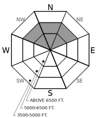
Tricky and dynamic conditions ahead. The weekend starts with dangerous wet snow avalanche conditions on Friday and transitions to cold, dry snow avalanche problems by Sunday. On Friday, avoid steep terrain where the snowpack is wet or receiving rain. After the snowpack refreezes later in the weekend, instabilities should be confined to new and wind blown snow, with lingering persistent slab hazards on upper-elevation, shaded slopes.

No Rating
?
Above 6500 ft.
No Rating
?
5000-6500 ft.
No Rating
?
3500-5000 ft.
-
Type ?
-
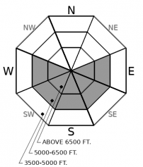
Aspect/Elevation ?
-
Size ?HistoricVery LargeLargeSmall

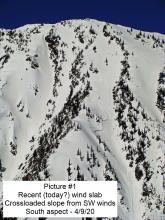
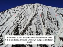
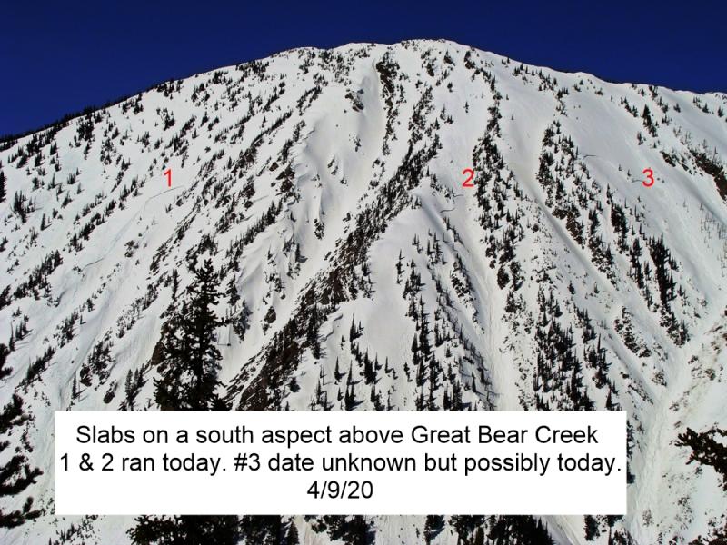
The past week, large slab avalanches have released on buried weak layers and crusts from solar warming (Example). The slabs have evolved from dry to wet with several days of warm weather, particularly on sunny aspects. On Thursday, an observer reported "collapsing corn," an early warning sign for wet slabs. A poor refreeze on Thursday night and continued warm temperatures and rain through Friday night will exacerbate the threat of wet slabs breaking several feet thick. Avoiding steep terrain until the upper snowpack has refrozen solid is the only reliable way to manage this concern. This will start to happen on Saturday morning. Wet loose avalanches will also be a widespread hazard on any steep terrain harboring moist or wet snow, regardless of aspect.
-
Type ?
-
Aspect/Elevation ?
-
Size ?HistoricVery LargeLargeSmall

Persistent slabs have continued to fail naturally this week, triggered by wind loading, warming, or cornice falls (Example A, Example B, Example C, Example D). The sensitivity of facets and faceted crusts buried 2 to 3 feet deep will decrease through the weekend. However, as this problem develops into a low likelihood / high consequence concern, it should continue to dictate your terrain choices. Carefully assess the snowpack before traveling on suspect aspects, where a dry snowpack has survived through this week's warming. Be wary of overhead hazards; falling chunks of cornice can act as triggers. Recognize that persistent slabs exhibit unusual behavior such as erratic feedback, wide propagation, and remote trigger potential.
-
Type ?
-
Aspect/Elevation ?

-
Size ?HistoricVery LargeLargeSmall

Strong northeast winds will drift new snow into sensitive slabs on Saturday and Sunday. The size and danger posed by these slabs will vary by mountain range, with the largest slabs in areas with the greatest snowfall. Pay attention to how much new snow is accumulating on top of recent crusts, and how much blowing snow there is. Stay away from steep terrain if you find more than about 8" of drifted snow. Shooting cracks and blowing snow are signs of instability.
An abrupt change in weather will bring a fuzzy transition from wet to dry avalanche concerns over the next three days.
Wet Problems: Friday into Saturday. Wet avalanche instabilities and warming-related slab releases have occurred all week. Thursday was the hottest day yet, with the furnace blazing beyond 50 degrees in the mountains. Mountain temperatures remained above freezing on Thurday night. Wet instabilities will peak on Friday, with continued warm temperatures and rain. In terrain where the snowpack has been getting wet all week, the threat of dangerously large wet slabs should dictate your travel decisions. On northerly facing terrain where the snowpack remains mostly dry, rain on snow and warming temperatures will increase the threat of wet loose avalanches and persistent slabs. Friday looks like a challenging day for managing avalanche hazards, and a good day to choose simple terrain or simply enjoy valley activities.
Dry Problems: Saturday in Sunday. A cold front will cross the region on Friday night. This will start to alleviate wet avalanche concerns by Saturday morning, although the timing of when the snowpack refreezes will vary. Once the snow surface refreezes into a solid and supportive crust, concerns will shift towards new and wind blown snow. Winds will peak out of the northeast on Saturday. Snowfall looks to favor the Continental Divide, with up to a foot of accumulated snow by Sunday. Expect wind slabs to form in atypical locations and they will be larger in areas that receive more snow. As temperatures decrease, the concerns for persistent slab activity will diminish, but not entirely go away.
This is an off-season snowpack update. The next update will be issued on Monday, April 13.
This forecast applies only to backcountry areas outside established ski area boundaries. The forecast describes general avalanche conditions and local variations always occur. This forecast expires at midnight on the posted day unless otherwise noted. The information in this forecast is provided by the USDA Forest Service who is solely responsible for its content.


