| Wednesday | Wednesday Night | Thursday | |
|---|---|---|---|
| Cloud Cover: | Partly Cloudy | Mostly Clear | Mostly Clear |
| Temperatures: | 15 to 20 deg. F. | 9 to 12 deg. F. | 21 to 26 deg. F. |
| Wind Direction: | West | Southwest | Southwest |
| Wind Speed: | 13G25 | 13G23 | 12 |
| Snowfall: | 0" in. | 0" in. | 0" in. |
| Snow Line: | 0' | 500' | 500' |
Whitefish Range
Flathead Range and Glacier National Park
How to read the forecast
Avalanches failing on weak layers buried over 2 feet deep are the primary concern today. Be conservative and steer away from slopes steeper than about 35 degrees. Use caution on the terrain that connects to start zones as you gain elevation. Limit your overhead exposure to large avalanche paths. The most dangerous slopes are near and above treeline where recent winds have drifted new snow.

3. Considerable
?
Above 6500 ft.
2. Moderate
?
5000-6500 ft.
1. Low
?
3500-5000 ft.
- 1. Low
- 2. Moderate
- 3. Considerable
- 4. High
- 5. Extreme
-
Type ?
-
Aspect/Elevation ?

-
Likelihood ?CertainVery LikelyLikelyPossible
 Unlikely
 -
Size ?HistoricVery LargeLargeSmall

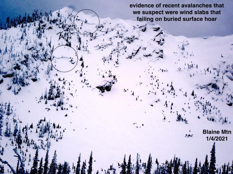
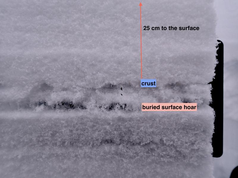
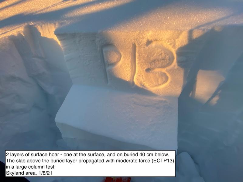
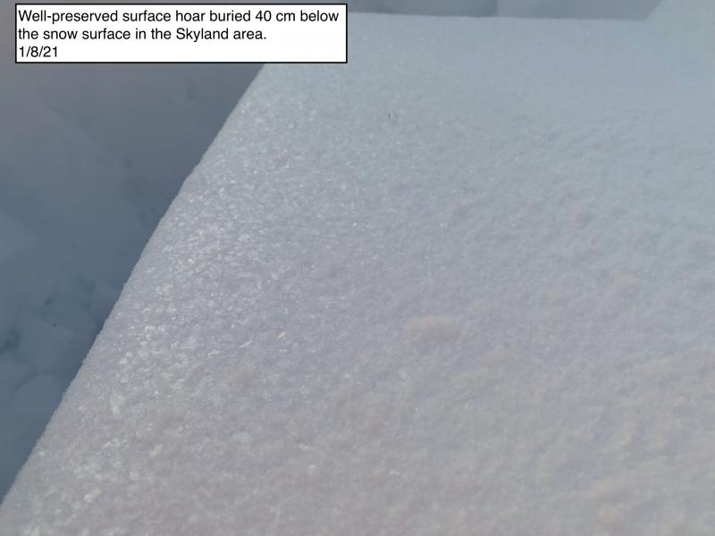
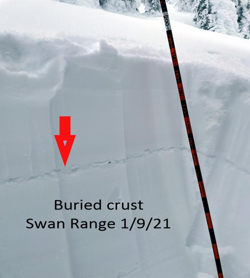
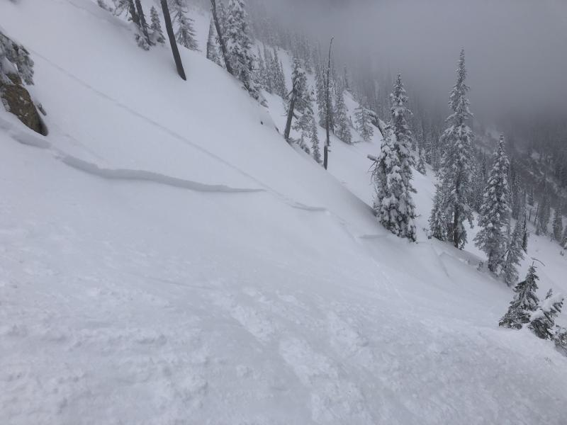
Layers of surface hoar and faceted crusts are buried under 2+ feet of snow. Tuesday morning's rain didn’t reach higher than about 6,000 feet, so the snowpack up high is not locked up like at lower elevations. Over the past week, reports of both human triggered, and natural avalanches failing on one of these weak layers have come from across the forecast zone. We have a lot of uncertainty over where these layers are still reactive. The continuous loading has likely pushed them near the tipping point for triggering. Treat steep slopes with caution as you gain elevation. Limit your exposure to large avalanche paths and adjacent slopes.
-
Type ?
-
Aspect/Elevation ?

-
Likelihood ?CertainVery LikelyLikelyPossible
 Unlikely
 -
Size ?HistoricVery LargeLargeSmall

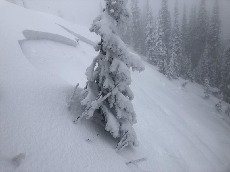
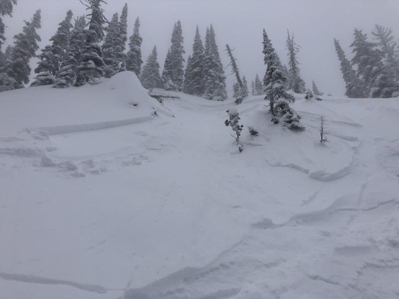
Expect storm slabs to take longer to heal on leeward aspects where strong winds yesterday morning drifted snow into a thicker, harder slabs. Monitor how the new snow is bonding to underlying surfaces before committing to steep terrain. Cracking in new snow is a sign to stay off of slopes steeper than about 35 degrees with trigger points like breakovers. There is a possibility of a smaller avalanche stepping down to a more dangerous, persistent slab avalanche.
Early Tuesday morning, the Flathead Range went through a cycle of small to large natural avalanches. Rain crept up above 6,000 feet, and loose wet slides ran down to the valley floor on east and southeast aspects.
The temperature fell as arctic air moved in, dropping 6 inches of light cold snow before noon. During that period, strong northerly and westerly winds drifted that new snow in high, unprotected terrain. One observer, who lamented starting his tour too early during the squall, noted cracking in an exposed area near 6,000 feet. In my travels at lower and mid elevations, the new morning snow was fairly well bonded. The wet snow below was refreezing and gaining strength throughout the afternoon. The new rain crust was reported to about 5,900 feet in the southern Whitefish Range. So, below about 6,000 feet I expect that the wet snow has locked up and we are dealing with surface instabilities. Storm slabs sitting above the most recent rain crust will be increasingly stubborn to trigger. Though I would recommend tracking how well the new snow is bonding to the crust before venturing onto slopes steeper than about 35 degrees, especially where the wind has stiffened slabs.
At upper elevations, recent precipitation likely fell as snow and there is no rain crust covering deeper weak layers. Surface hoar and faceted crusts buried 1.5 to 2+ feet deep have been continuously loaded since mid December. We have a lot of uncertainty about where and how sensitive these layers are. It’s hard to imagine that they are not near the tipping point for human triggering. Smaller storm slabs are another possible trigger for deeper, more dangerous slides as well. Triggered slides that step down to one of the weak layers could be large enough to bury or kill you. Large avalanches were triggered remotely and stepped down to old weak snow during mitigation work at Whitefish Mountain Resort on Monday. As I climb higher, I will be more cautious and conservative. I’ll be treating slopes steeper than about 35 degrees, and connected terrain, as suspect. I’ll be limiting my overhead exposure to large avalanche paths with alpine start zones. I’ll pay close attention to shooting cracks or collapsing. I'll avoid areas where the wind has stiffened storm slabs into deep drifts because these slopes will be the most dangerous.
Because the Swan Range has less terrain above yesterday’s rain, I expect storm slabs to be the primary problem, with persistent slabs being more isolated.
The area remains under northerly flow this morning with an odd shower possible in the Swan Range. Winds will be trending downward as high pressure moves over our area tonight. Calm condtions will prevail tomorrow as the ridge remains in place. The next chance for precipitation looks to be Friday.
This forecast applies only to backcountry areas outside established ski area boundaries. The forecast describes general avalanche conditions and local variations always occur. This forecast expires at midnight on the posted day unless otherwise noted. The information in this forecast is provided by the USDA Forest Service who is solely responsible for its content.


