Forecaster Observation - very small wind slab, southern Glacier Park

Location Name: 
Forecaster Observation - very small wind slab, southern Glacier Park
Region: 
Glacier National Park - Southern Lewis Range
Date and time of avalanche (best estimate if unknown): 
Thu, 12/29/2016 - 11:00
Location Map: 


Red Flags: 
Recent avalanche activity
Recent loading by new snow, wind, or rain

Observation made by: Forecaster
Avalanche Observations
Avalanche Type: 
Dry
Slope: 
38degrees
Trigger type: 
Skier
Crown Height: 
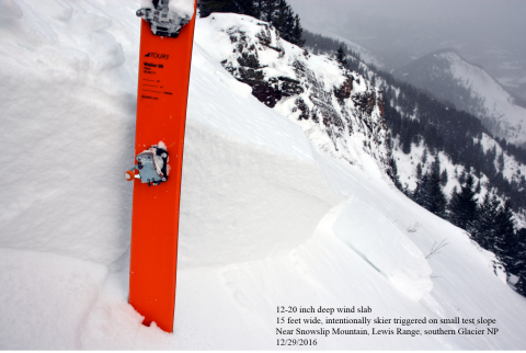
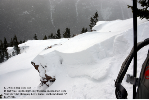
1 ft
Aspect: 
East
Weak Layer: 
Within storm snow
Avalanche Width: 
15ft.
Terrain: 
Near Treeline
Elevation: 
5 600ft.
Bed Surface: 
Old Snow
Avalanche Length: 
5ft.
More detailed information about the avalanche: 

We ascended the Shed 6/7 ridge (a spur ridge off of the southeast ridge of Snowslip Mt.) in the Lewis Range in southern Glacier NP. From a safe location above the ridge, we intentionally triggered a very small wind slab avalanche. The avalanche was only 15 ft. wide and did not propagate across the entire slope. It was also rather stubborn to trigger, and took a fair amount of stomping on top of the ridge for it to release. The location was a small, east facing test slope that was heavily wind loaded. The avalanche is classified as SS-ASc-D0.5-R1-I

We observed no other avalanche activity throughout John F. Stevens Canyon, and the visibility was fair. 

Snowpit or crown profile photo or graph: 
Avalanche observation video: 

December 29, 2016 - small wind slab, southern Glacier National Park

Weather Observations
Blowing Snow: 
Yes
Cloud Cover: 
100% of the sky covered by clouds
Air temperature: 
Below Freezing
Wind Speed: 
Moderate (Small trees sway)
Precipitation: 
Snow
Air temperature trend: 
Warming
Wind Direction: 
Southwest
Accumulation rate: 
Less than 1 in. per hour
More detailed information about the weather: 

Moderate southwest winds with strong gusts throughout the day. Snow accumulation of 0.5 to 1.0 inches per hour as well. Visbility was poor to fair.

Activity: 
Skiing