

Avalanche Forecast published on October 20, 2017 @ 9:35 am
Issued by
Zach Guy - Flathead Avalanche Center
Whitefish Range
Swan Range
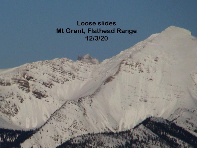
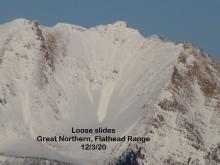
Flathead Range and Glacier National Park
How to read the forecast
Fall Advisory Statement: A series of increasingly powerful systems will bring snow and wind to high elevations through the weekend. Watch for changing conditions and isolated instabilities developing on wind-loaded slopes above treeline. Exposed rocks and cliffs will amplify the consequences of an avalanche. Identify and avoid thicker deposits of wind-drifted snow. The FAC will monitor conditions through the fall and post updates as the snowpack evolves.

No Rating
?
Above 6500 ft.
No Rating
?
5000-6500 ft.
No Rating
?
3500-5000 ft.
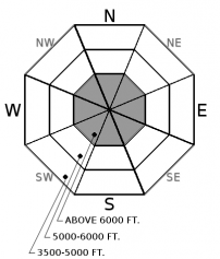
Avalanche Problem 1: Wind Slab
-
Type ?
-
Aspect/Elevation ?
-
Size ?HistoricVery LargeLargeSmall

New snow accompanied by strong winds will form fresh wind slabs on leeward or crossloaded alpine terrain. These could be up to several feet thick by the end of the weekend. Avoid windloaded features below ridgelines or in gullies, where the snow coverage is smooth, pillowy, and thick enough to cover rocks and vegetation. Slopes or terrain features holding smooth, existing snow coverage prior to this storm are most suspect; these are generally high elevation northerly aspects.


Avalanche Problem 2: Loose Wet
-
Type ?
-
Aspect/Elevation ?
-
Size ?HistoricVery LargeLargeSmall
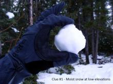
New snow accumulating this weekend can sluff off of rocks and out of gullies in the form of loose snow avalanches, especially as the snow moistens from warming temperatures or rain-on-snow. Rollerballs or small point releases shedding off of very steep slopes are warning signs to be mindful of overhead hazards if you are climbing in severe terrain.


Forecast discussion
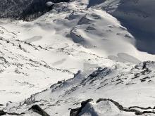
Snow coverage remains spotty or non-existent on most terrain, so this arriving snowfall won't be accumulating over slick or weak bed surfaces in most terrain. Any instabilities in the new snow will generally be confined to windloaded terrain features at high elevations where there is existing snow coverage or rapid loading from wind transport.
The recent avalanche fatality in Southwestern Montana is a tragic reminder that avalanches can happen this time of year. The report is here. If you are hiking, climbing, or skiing on snow covered slopes at higher elevations, be prepared for avalanche threats. Carry avalanche gear (beacon, shovel, probe), cross avalanche terrain one at a time, and check for updates on avalanche conditions. The FAC will monitor conditions through the fall and post updates as the snowpack evolves. More detailed daily advisories will begin late November or as conditions warrant.
Dust off the avalanche cobwebs by attending our 7th annual Northern Rockies Snow and Avalanche Workshop on November 4th. It is going to be a great event and registration is now open!

Weather and CURRENT CONDITIONS
weather summary
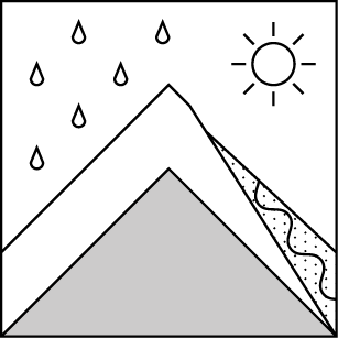
A cold front will move into NW Montana on Friday. We'll see 2-5" of snow accumulate at higher elevations under gusty westerly winds. A warmer but more potent system driven by the jet stream arrives Saturday evening. This will bring up to several inches of liquid water equivalent through the rest of the weekend and strong W/SW winds. Pack your rain jacket: The freezing level is forecasted to hover around 6,000 ft - 7,000 ft., but more than a foot of snow could accumulate at higher elevations. Drier weather returns next week.
Disclaimer
This advisory applies only to backcountry areas outside established ski area boundaries. This advisory describes general avalanche conditions and local variations always occur. This advisory expires at midnight on the posted day unless otherwise noted. The information in this advisory is provided by the USDA Forest Service who is solely responsible for its content.
Search
Follow or Subscribe


In Partnership With

In Partnership With
