

Avalanche Forecast published on November 1, 2017 @ 8:18 pm
Issued by
Zach Guy - Flathead Avalanche Center
Whitefish Range
Swan Range
Flathead Range and Glacier National Park
How to read the forecast
Early Season Snowpack Update: A winter storm will bring an increased threat of storm instabilities on some high elevation slopes into this weekend. Mountain travelers should anticipate changing conditions, monitor storm totals, and carry avalanche gear.
The FAC will monitor conditions through the fall and post updates as the snowpack evolves.

No Rating
?
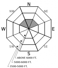
Above 6500 ft.
No Rating
?
5000-6500 ft.
No Rating
?
3500-5000 ft.
Avalanche Problem 1: Storm Slab
-
Type ?
-
Aspect/Elevation ?
-
Size ?HistoricVery LargeLargeSmall

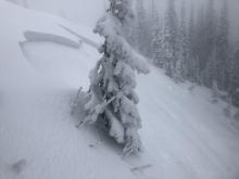
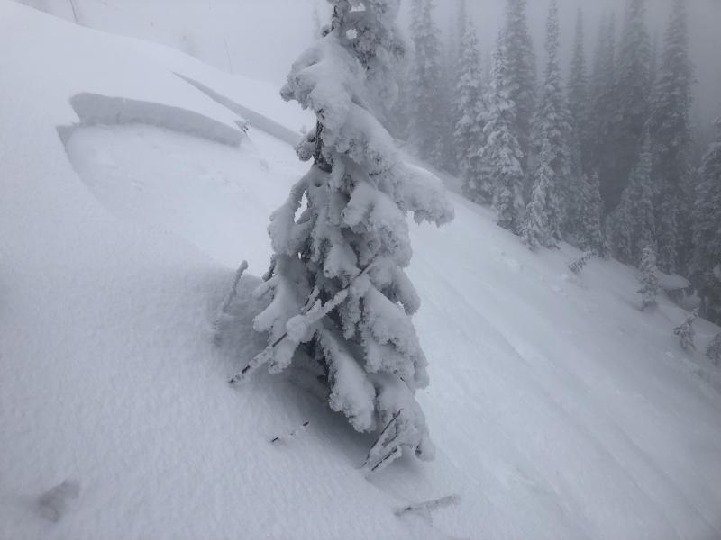
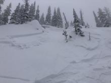
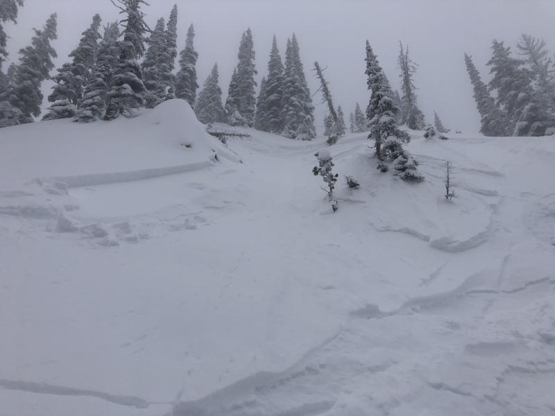
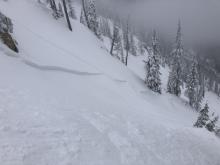
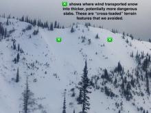
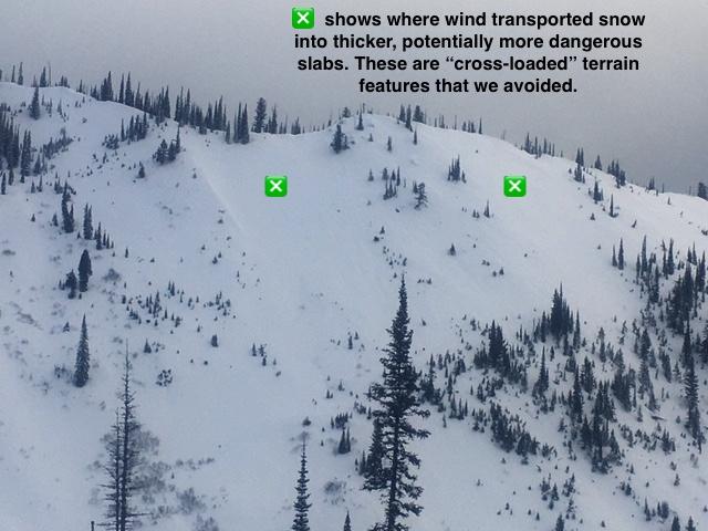
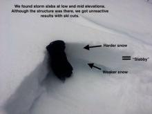
Storm totals of 15" to 20" are expected by this weekend. The threat and potential size of avalanches breaking in the new snow will increase over the next couple days. Fresh storm slabs, loose snow avalanches, and wind slabs are most likely to be triggered on slopes holding existing and continous snow coverage prior to this storm: generally northerly facing terrain at upper elevations with some isolated exceptions. Use extra caution if you are traveling on slopes with more than a foot of new snow overlying old crust layers or if you encounter significant windloading.


Forecast discussion
As of Wednesday evening, around 3" of new snow has blanketed our mountains with some favored southern locations in the Swan and Mission Ranges showing a foot of snow. We should see a ramp-up in snowfall on Thursday favoring the northern ranges. The new snow is mostly accumulating on bare ground, which will minimize avalanche concerns on these slopes for now. The areas of most concern are slopes with existing continous snow coverage left over from our last storm. You can find a residual patchy network of old crusts above 6,000 feet, mostly on shaded slopes or in some gullies on other aspects. Storm slabs that form over these older layers will be sensitive to human triggers on terrain features steeper than 35 degrees, especially in wind-affected terrain. With a NE and E wind direction in the forecast, keep an eye for unusual wind loading patterns and thicker slabs on leeward aspects if winds increase during the storm.
The 7th annual Northern Rockies Snow and Avalanche Workshop is this Saturday. We have a great lineup of speakers and a killer raffle, so don't miss it!

The FAC will monitor conditions through the fall and post updates as the snowpack evolves. More detailed daily advisories will begin late November or as conditions warrant.
Weather and CURRENT CONDITIONS
weather summary
A stationary front is draped across the MT/ID border Wednesday evening, with a cold Canadian airmass bringing light snowfall to Northwestern Montana. A moisture surge will override the cold front on Thursday, intensifying snowfall across the region. Favorable snowfall conditions carry into Friday before the powder bullseye shifts southward on Saturday. 15"-20" of new snow is expected out of this storm, and some favored locations may exceed two feet. Winds are forecasted to remain fairly well-behaved out of the Northeast and East during this system, averaging in the low teens and gusting into the 30's at mountain top level. The freezing level will remain below valley floor throughout, with mountain temperatures in the teens and low 20's. Unsettled weather continues next week. The National Weather Service in Missoula has begun daily backcountry weather forecasts for Northwest Montana here. We will resume detailed daily weather forecasts when we become fully operational.
Disclaimer
This advisory applies only to backcountry areas outside established ski area boundaries. This advisory describes general avalanche conditions and local variations always occur. This advisory expires at midnight on the posted day unless otherwise noted. The information in this advisory is provided by the USDA Forest Service who is solely responsible for its content.
Search
Follow or Subscribe


In Partnership With

In Partnership With
