

Avalanche Forecast published on November 3, 2017 @ 10:55 am
Issued by
Zach Guy - Flathead Avalanche Center
Whitefish Range
Swan Range
Flathead Range and Glacier National Park
How to read the forecast
Early Season Snowpack Update: Fresh snow and gusty northeasterly winds have created storm instabilities on windloaded and shaded aspects, especially at high elevations. Avalanches will be sensitive to human triggers, and an early season slide will result in an unpleasant ride given our thin snow coverage. Cracking snow and deeper drifts are signs to avoid steep terrain. Be prepared for avalanche hazards this weekend.
The FAC will monitor conditions through the fall and post updates as the snowpack evolves.

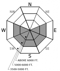
No Rating
?
Above 6500 ft.
No Rating
?
5000-6500 ft.
No Rating
?
3500-5000 ft.
Avalanche Problem 1: Wind Slab
-
Type ?
-
Aspect/Elevation ?
-
Size ?HistoricVery LargeLargeSmall

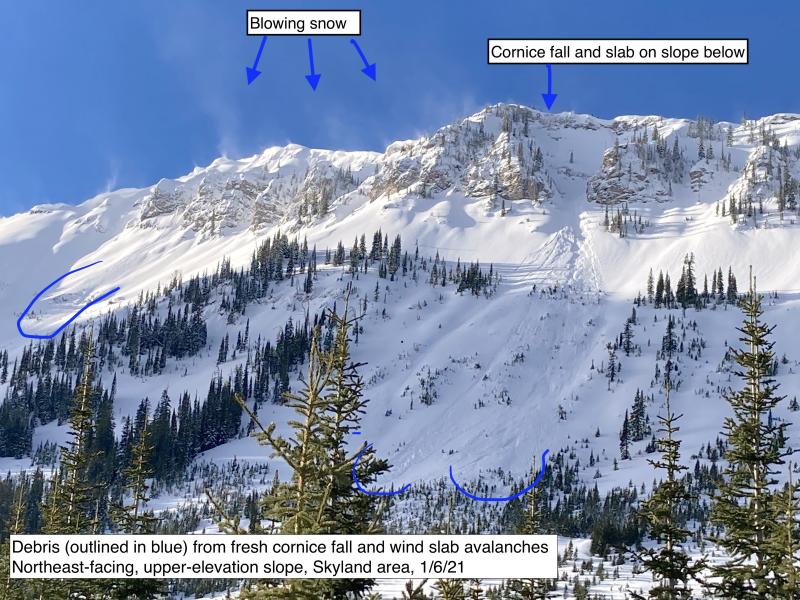
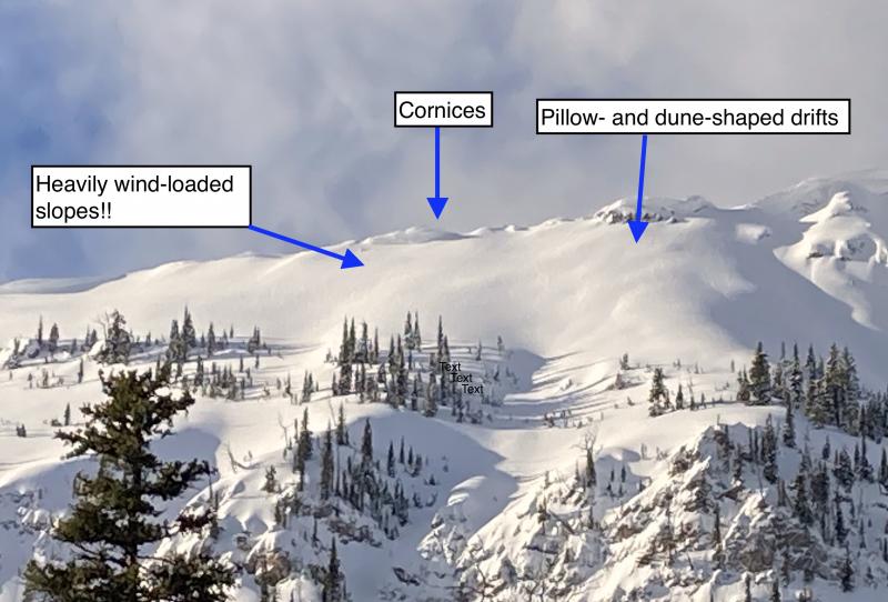
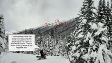
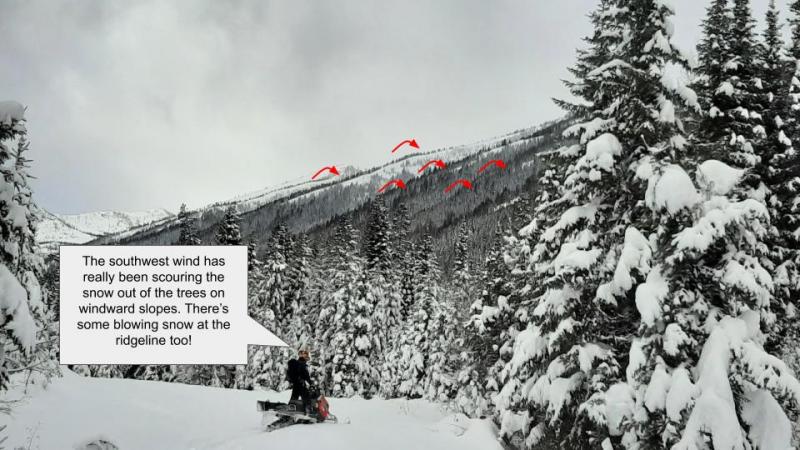
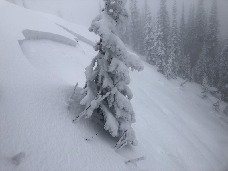
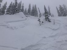
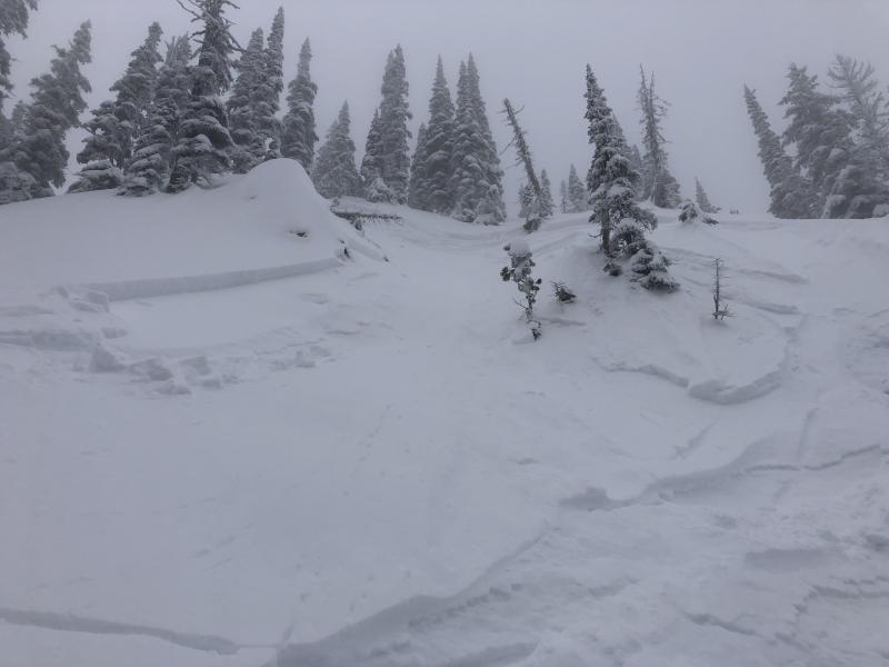
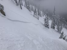
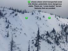
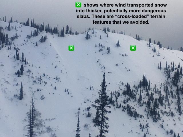
Gusty northeasterly winds have accompanied the recent low density snow, forming fresh wind slabs up to several feet thick onto leeward aspects. Avoid deeper drifts and pillowy looking snow on steep terrain. Be observant of recent wind transport patterns because the snow is drifting into atypical locations from northeastlerly winds, and winds are forecasted to shift to the northwest on Friday night.


Avalanche Problem 2: Storm Slab
-
Type ?
-
Aspect/Elevation ?
-
Size ?HistoricVery LargeLargeSmall
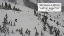
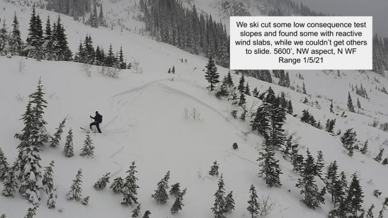
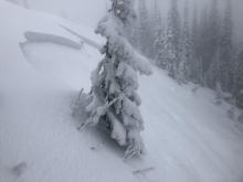
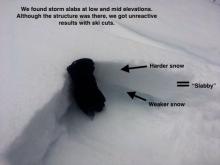
6 to 15" of storm snow has accumulated in the past few days, with a few more inches on tap through the weekend. This snow is bonding poorly to a variety of crusts and older weak layers that exist on high elevation, shaded aspects, exemplified in this video. Use caution if you encounter the combination of cohesive storm slab over older crusts on terrain steeper than about 35 degrees. Quick hand pits and a careful eye for cracking in the new snow are ways to assess the problem.


Forecast discussion
We are updating our fall travel advisory because the most recent system produced more wind and less snow than forecasted. The new snow is low density, and is easily drifting by these frigid northeasterly winds that have been blowing 20-30 mph at exposed locations. WInds will start shifting towards the northwest tonight, expanding the distribution of suspect slopes for the weekend. A lot of leeward slopes were bare prior to the storm, so wind slabs should mostly be confined to smaller pockets. You may be be able to trigger a large (D2) slab above treeline. Regardless of size, you don't want to get tangled in any kind of moving snow this time of year because you'll get dragged through a nasty combination of rocks, deadfall, and the occasional unruly grizzly bear who hasn't dug in for winter yet. In wind sheltered terrain, you aren't off the hook. Storm slab instabilities are a growing concern anywhere that the new snow is forming a cohesive slab over old snow layers. Zachtern highlighted this structure yesterday on a north aspect of Big Mountain. We have limited field data on the exact distribution of these underlying crusts right now, but they are generally found on shadier aspects and a few gullies or isolated features around the compass above 6,000 ft. Even on the low angle slopes, it is far from green-light riding conditions with our very thin snowpack and countless buried obstacles. Tread lightly if you are headed out for turns and be prepared for the worst, including shovel, probe, beacon, first aid kit, and plenty of warm layers.
The 7th annual Northern Rockies Snow and Avalanche Workshop is this Saturday. Registration closes today at 2 p.m., but you can still sign up at the venue, space permitting. We have a great lineup of speakers and a killer raffle, so don't miss it!

The FAC will monitor conditions through the fall and post updates as the snowpack evolves. More detailed daily advisories will begin late November or as conditions warrant.
Weather and CURRENT CONDITIONS
weather summary
We'll see the focus of snowfall shift away from us as the cold front continues advancing southward into Idaho and Wyoming. A couple more inches of snow and continued gusty winds prevail through this evening, before a break in the action arrives Saturday. Another snow event looks to head our way on Sunday and Monday, although not as potent as this last one. The National Weather Service in Missoula has begun daily backcountry weather forecasts for Northwest Montana here. We will resume detailed daily weather forecasts when we become fully operational.
Disclaimer
This advisory applies only to backcountry areas outside established ski area boundaries. This advisory describes general avalanche conditions and local variations always occur. This advisory expires at midnight on the posted day unless otherwise noted. The information in this advisory is provided by the USDA Forest Service who is solely responsible for its content.
Search
Follow or Subscribe


In Partnership With

In Partnership With
