

THIS AVALANCHE FORECAST EXPIRED ON December 5, 2017 @ 6:58 amAvalanche Forecast published on December 2, 2017 @ 6:58 am
Issued by
Mark Dundas - Flathead National Forest
Whitefish Range
Swan Range
Flathead Range and Glacier National Park
How to read the forecast
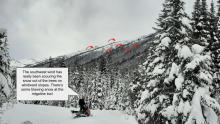
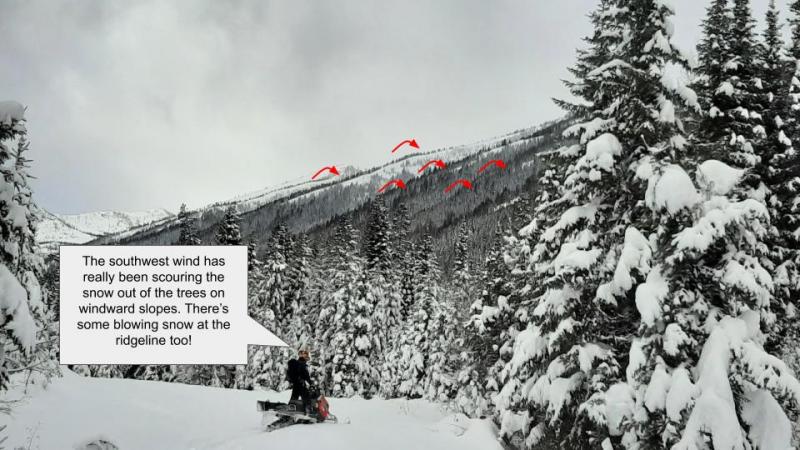
Recent incremental snowfall, combined with breezy westerly winds, has formed wind slabs on upper elevation leeward and cross loaded slopes. In many locations these slabs are resting on the stout Thanksgiving rain crust which may act as a slippery bed surface. Forecasted snow and wind Saturday night/Sunday will thicken these slabs and potentially increase the wind slab hazard. Evaluate all upper elevation wind loaded terrain before committing to a slope.

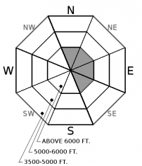
No Rating
?
Above 6500 ft.
No Rating
?
5000-6500 ft.
No Rating
?
3500-5000 ft.
Avalanche Problem 1: Wind Slab
-
Type ?
-
Aspect/Elevation ?
-
Likelihood ?CertainVery LikelyLikelyPossible
 Unlikely
 -
Size ?HistoricVery LargeLargeSmall

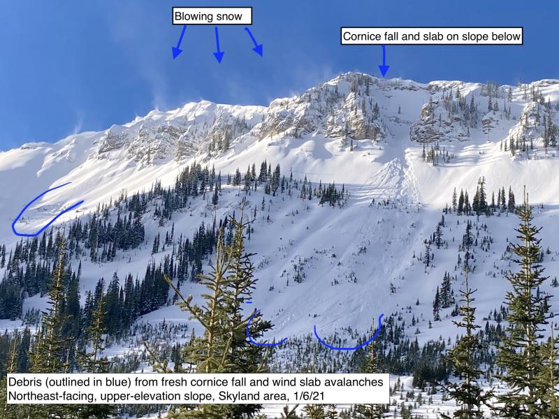
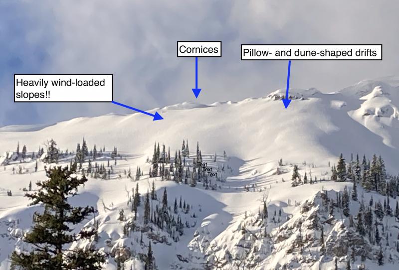
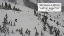
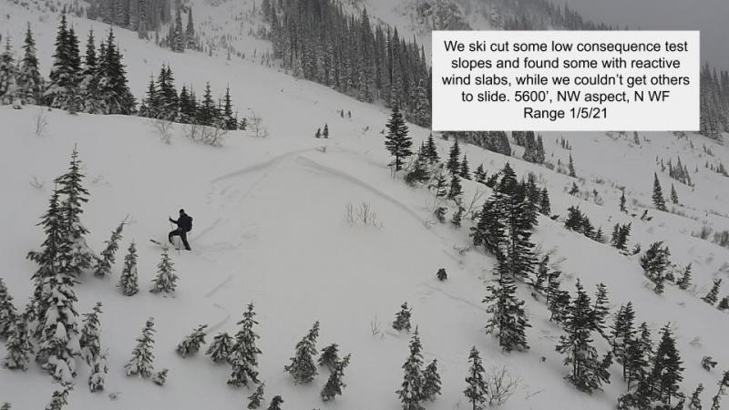
Since Tuesday, upwards of 8" of new snow has fallen at upper elevation weather stations across our advisory area. Westerly winds have redistributed this snow onto leeward aspects and cross loaded slopes forming fresh wind slabs up to 18" thick. Many of these slabs are now resting on the stout Thanksgiving rain crust (photo) which may act as a slippery bed surface in locations where the slab is not bonding well to this crust. Carefully evaluate all wind loaded terrain before committing to a slope today. Look for smooth, rounded features on the snow surface and pay attention to obvious signs of instability like cracking and collapsing while traveling along a ridgeline. Due to our thin snow cover the consequences of being caught and carried in a small avalanche is a legitimate concern.


Forecast discussion
Winter, or some semblance of, is slowly returning to our area after last weeks abnormally warm and wet conditions. This rain event was responsible for either washing all of the seasons snowpack away or leaving us with a stout rain crust that generally increases in thickness with elevation. At 5000' this crust is 2"+ with a 8-15" crust found above 6000'. Recent small storms, accompanied by our typical westerly winds, have formed wind slabs up to 18" thick in favored locations. The bonding between these wind slabs and the underlying slippery crust (bed surface) is our avalanche concern this weekend. With more snow on tap for tonight and tomorrow these slabs will thicken and possibly become more reactive. In sheltered upper elevation locations the new cohesionless snow may not bond well with the underlying crust and the potential for triggering a loose dry avalanche may become a concern if this weekends storm totals reach or exceed forecasted amounts. Both of the above mentioned problems are easy to identify because they are on the surface and because our snowpack is so thin. Stick your hand or shovel into the snow and test the bonding between the surface snow and the crust.
Our snowpack observations are limited so if your out and about in the mountains, send us your observations. A picture is worth a thousand words so any information can help us improve our product.
Weather and CURRENT CONDITIONS
weather summary
Small storms over the past few days have deposited 8" of snow/1.5" of SWE at Stahl Peak in the northern Whitefish Range, 5" of snow at WMR in the southern Whitefish Range and 6" of snow/1" of SWE at Noisy Basin in the Swan Range. Breezy westerly winds along with temperatures in the upper 20's to low 30's at upper elevations accompanied this snowfall. Today we can expect temperatures in the mid-20's with very light snow and light westerly winds. A cold front enters our area tonight depositing upwards of 6-8" of snow by Sunday evening. Unfortunately a strong ridge of high pressure will encompass our area for most of next week.
Disclaimer
This advisory applies only to backcountry areas outside established ski area boundaries. This advisory describes general avalanche conditions and local variations always occur. This advisory expires at midnight on the posted day unless otherwise noted. The information in this advisory is provided by the USDA Forest Service who is solely responsible for its content.
Search
Follow or Subscribe


In Partnership With

In Partnership With
