


For 5000 ft. to 7000 ft.
| Sunday | Sunday Night | Monday | |
|---|---|---|---|
| Cloud Cover: | Cloudy with light snow and moderate winds. | Heavy snow and strong winds. | Heavy snow and strong winds. |
| Temperatures: | 22-27 deg. F. | 20-25 deg. F. | 29-34 deg. F. |
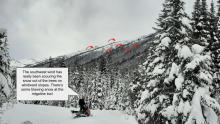
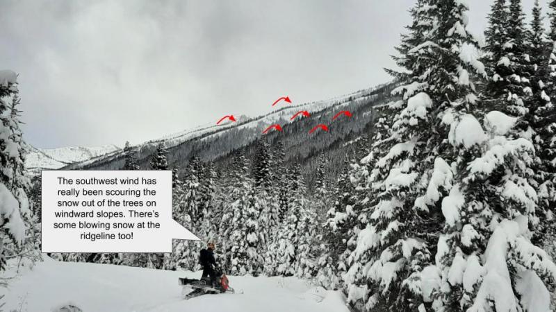
| Wind Direction: | Southwest | Southwest | West |
| Wind Speed: | 10-15 mph with gusts to 30 | 15-20 mph with gusts to 50 | 15-20 mph5 with gusts to 50 mph |
| Snowfall: | 1-2 in. | 3-6 in. | 4-8 in. |
| Snow Line: |


